Oil & Gas Drone Inspection | Pipelines, Refineries, Storage Tanks, LiDAR & Thermal
Aeroyantra delivers oil and gas drone inspection with LiDAR and thermal imaging for pipelines, refineries, storage tanks, and midstream assets. Reduce risk, cut downtime, and stay compliant.
Oil & Gas Drone Inspection | Pipelines, Refineries, Storage Tanks, LiDAR & Thermal
Aeroyantra delivers oil and gas drone inspection with LiDAR and thermal imaging for pipelines, refineries, storage tanks, and midstream assets. Reduce risk, cut downtime, and stay compliant.
Table Of Content
- Oil & Gas Drone Inspection: Inspect Every Asset. Enter No Hazardous Zone.
- Why Manual Oil and Gas Asset Inspection Is Expensive, Slow, and Dangerous
- Survey-Grade Drone Inspection for Every Oil and Gas Asset Type
- Pipeline Drone Inspection and Right-of-Way (ROW) Monitoring Across Hundreds of Kilometers
- Refinery Drone Inspection Without Scaffold, Rope Access, or Shutdown
- Storage Tank Drone Inspection Without Climbing, Rope Access, or Shutdown
- Flare Stack Drone Inspection Without Rope Access or Hot Work Permits
- Oil and Gas Construction Monitoring with Drone Surveys - From Earthworks to Commissioning
- Environmental Monitoring and Compliance Documentation for Oil and Gas
- Oil and Gas Digital Twin: A Living 3D Record of Every Asset
- Complete Deliverables by Asset Type
- Who Uses Aeroyantra for Oil and Gas Inspection
- Frequently Asked Questions
- Ready to Inspect Every Asset Without Sending Anyone Into a Hazardous Zone?
Oil & Gas Drone Inspection: Inspect Every Asset. Enter No Hazardous Zone.
Manual inspection of oil and gas assets puts people in the places where failures happen. Flare stacks, storage tank roofs, pipeline right-of-ways, and offshore platform structures are the assets most likely to fail - and the most dangerous places to send an inspection crew.
Aeroyantra is an oil and gas drone inspection and reality capture platform that combines photogrammetry, LiDAR, and thermal imaging for asset integrity monitoring and compliance. Aeroyantra delivers drone mapping, LiDAR scanning, and thermal inspection for oil and gas assets - so your teams can detect corrosion, monitor structural integrity, track pipeline right-of-way conditions, and maintain compliance documentation without exposing personnel to the hazards that come with manual inspection of live assets.
Why Manual Oil and Gas Asset Inspection Is Expensive, Slow, and Dangerous
Oil and gas asset inspection has not fundamentally changed in decades. Rope access teams rappel down flare stacks. Inspection crews walk pipeline corridors across difficult terrain. Tank inspectors climb external structures on live storage vessels. Scaffold is erected around process equipment for visual inspection cycles that take weeks.
This approach has three compounding problems:
-
It is dangerous - The assets most likely to have integrity issues are the assets most dangerous to inspect manually. Rope access fatalities, confined space incidents, and exposure to hydrocarbon atmospheres are recurring features of traditional inspection programs
-
It is infrequent - The cost and logistics of manual inspection mean assets are inspected on long cycles - annually or less frequently for many asset types. Problems that develop between inspection cycles go undetected until they become failures
-
It produces incomplete data - A rope access inspector covering a flare stack produces visual observations and photographs. It does not produce a georeferenced, quantified record of surface condition, wall geometry, or deformation that can be compared against the previous inspection cycle
The consequence is an inspection program that is simultaneously expensive, risky, and less effective than it should be.
Drone inspection changes the economics and the safety profile of every one of these asset types.
Survey-Grade Drone Inspection for Every Oil and Gas Asset Type
Aeroyantra delivers drone mapping, LiDAR scanning, and thermal inspection workflows for the full range of oil and gas asset types - onshore pipelines, refineries, storage tanks, flare stacks, process facilities, and midstream infrastructure.
With RTK, PPK, and GCP-supported workflows, Aeroyantra achieves 2-3 cm horizontal accuracy and LiDAR precision suitable for structural geometry verification, corrosion mapping, and deformation monitoring across complex industrial environments.
What that means for oil and gas operators:
-
No personnel in hazardous zones - All inspection data collected from drone altitude - no rope access, no confined space entry, no scaffold erection on live assets
-
Quantified condition data, not visual observations - LiDAR geometry, thermal anomalies, and photogrammetric surface models replace subjective visual inspection records with measured, comparable data
-
Shorter inspection cycles at lower cost - A single drone flight covers asset areas that would take inspection crews days or weeks to access manually
-
Time-series change detection - Repeat surveys registered to a common datum, enabling detection of corrosion progression, structural deformation, and condition change between inspection cycles
-
Compliance-ready documentation - Georeferenced, time-stamped inspection records formatted for regulatory compliance requirements
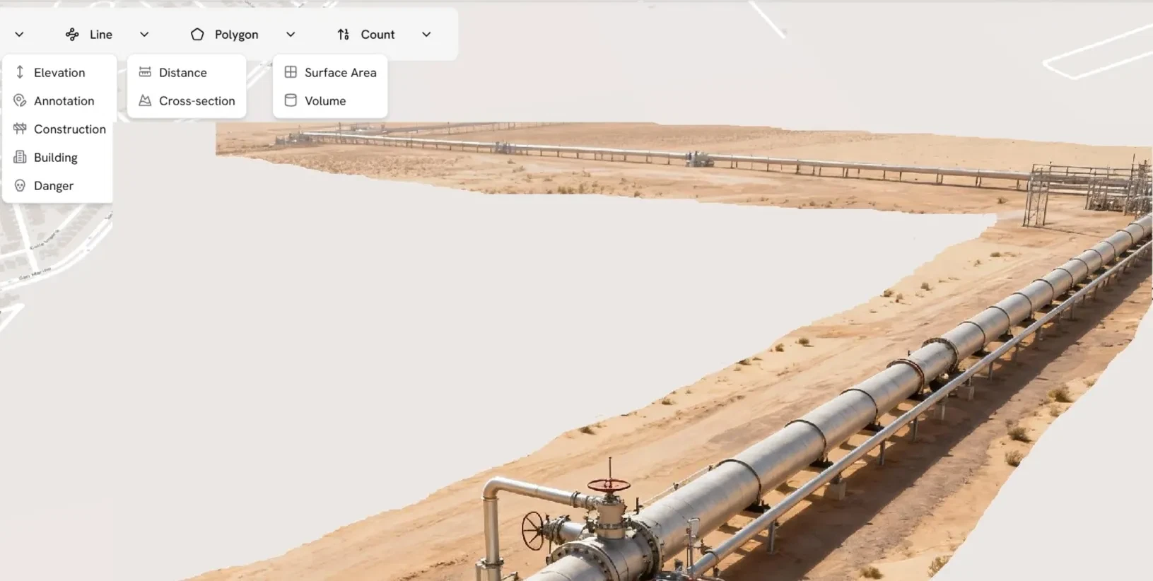
Pipeline Drone Inspection and Right-of-Way (ROW) Monitoring Across Hundreds of Kilometers
Pipeline networks are the most difficult oil and gas asset type to inspect consistently. Long distances across varied terrain, remote locations, and the need for frequent monitoring to detect third-party interference, encroachment, and right-of-way vegetation make manual inspection economically unviable at the frequency that safety and compliance require.
This enables continuous pipeline drone inspection and right-of-way monitoring at a scale that manual patrols cannot match. Aeroyantra delivers drone-based pipeline inspection and right-of-way monitoring that covers hundreds of kilometers per day - producing a complete, georeferenced record of pipeline corridor condition at every survey cycle.
Right-of-Way Monitoring
-
Corridor orthomosaic - High-resolution aerial imagery of the full pipeline corridor showing current ground conditions, encroachment, and land use changes
-
Encroachment detection - Identification of unauthorized construction, agricultural activity, and land use changes within the pipeline right-of-way buffer zone
-
Vegetation management monitoring - Identification of tree growth, vegetation encroachment, and canopy height violations within the right-of-way clearance zone
-
Third-party activity detection - Identification of digging, construction, and other third-party activities near the pipeline route that create interference risk
-
Erosion and washout detection - Identification of erosion, slope failure, and water crossings threatening pipeline exposure or cover loss
-
River and water crossing monitoring - Aerial assessment of pipeline crossings at rivers, streams, and water bodies for scour, exposure, and encroachment
Pipeline LiDAR Inspection
-
Pipeline route terrain model - High-accuracy DTM of the pipeline corridor for slope stability assessment, drainage analysis, and route condition monitoring
-
Above-ground pipeline geometry - Precise 3D capture of above-ground pipeline sections, supports, and fittings for deformation and settlement monitoring
-
Cathodic protection structure mapping - Georeferenced mapping of test posts, anodes, and cathodic protection infrastructure along the corridor
-
Valve and fitting location mapping - Precise georeferenced location of surface valves, inspection pits, and pipeline markers
-
Bare-earth terrain under canopy - LiDAR penetration through vegetation to capture ground surface beneath tree cover for pipeline route stability assessment
Thermal Pipeline Inspection
-
Leak detection - Thermal anomalies indicating product leakage from buried or above-ground pipeline sections
-
Insulation failure detection - Thermal contrast identifying insulation damage or failure on insulated pipeline sections
-
Hot tap and connection monitoring - Thermal assessment of hot tap locations and mechanical connections for anomalous temperature signatures
Refinery Drone Inspection Without Scaffold, Rope Access, or Shutdown
Refinery inspection programs built around scaffold erection, rope access, and planned shutdown windows are expensive, infrequent, and expose inspection personnel to the hazardous environments where failures occur. Drone inspection enables continuous monitoring of refinery assets between planned turnarounds - detecting developing issues before they require emergency intervention.
LiDAR and thermal drone inspection replace scaffold and rope access with quantified, repeatable inspection data.
What Aeroyantra delivers for refinery inspection:
Visual and photogrammetric inspection:
-
High-resolution external condition survey - Detailed aerial imagery of refinery structures, vessels, and equipment for visual condition assessment without scaffold or rope access
-
3D facility model - Photogrammetric 3D model of the full refinery for asset documentation, change detection, and digital twin maintenance
-
Structural condition documentation - Georeferenced, time-stamped record of structural condition for each inspection cycle, enabling comparison against previous surveys
-
Corrosion and surface degradation mapping - High-resolution imagery enabling identification of external corrosion, coating failure, and surface degradation on vessels and structures
LiDAR inspection:
-
Vessel and column geometry verification - Precise 3D capture of vessel walls, column geometry, and structural elements for deformation detection and integrity monitoring
-
Pipe rack and structural steel inspection - Point cloud capture of pipe rack geometry, structural connections, and support conditions for settlement and deformation monitoring
-
Flare stack geometry and alignment - Precise vertical alignment and geometric deformation monitoring of flare stacks without rope access
-
Settlement and subsidence monitoring - Time-series LiDAR comparison to detect foundation settlement and structural subsidence across the facility
Thermal inspection:
-
Heat exchanger and vessel hotspot detection - Thermal anomalies indicating fouling, insulation failure, or process anomalies on heat exchangers and pressure vessels
-
Electrical infrastructure inspection - Hotspot detection at switchgear, motor control centers, cable trays, and electrical distribution equipment
-
Refractory and furnace monitoring - External thermal mapping of furnace walls and refractory linings to detect hot spots and failure zones
-
Steam trap and insulation inspection - Identification of failed steam traps, insulation damage, and heat loss points across the facility
Storage Tank Drone Inspection Without Climbing, Rope Access, or Shutdown
Storage tanks are among the most hazardous assets to inspect manually - and among the most critical to monitor consistently. External corrosion, roof condition, foundation settlement, and secondary containment integrity are all measurable from drone altitude without taking the tank out of service or exposing personnel to hydrocarbon atmospheres.
What Aeroyantra delivers for storage tank inspection:
External condition assessment:
-
Shell and roof condition survey - High-resolution aerial imagery of tank shell, roof, and external fittings for corrosion, coating failure, and mechanical damage identification
-
Floating roof inspection - Aerial inspection of floating roof seals, pontoons, and drainage systems without personnel access to the roof surface
-
Nozzle and fitting documentation - Georeferenced record of external nozzle positions, valve locations, and fitting conditions
-
Secondary containment inspection - Aerial inspection of bund walls, drainage systems, and secondary containment surfaces for integrity assessment
LiDAR tank inspection:
-
Tank shell geometry - Precise 3D capture of tank shell geometry for roundness verification, out-of-plumb detection, and deformation monitoring
-
Settlement monitoring - Foundation settlement detection from time-series LiDAR surveys, identifying differential settlement before it creates structural risk
-
Volume calculation - External LiDAR-derived volume calculation for above-ground storage tanks
-
Tank farm layout documentation - Precise georeferenced mapping of tank farm layout, spacing, and infrastructure for safety and emergency planning
Thermal tank inspection:
-
Product level detection - Thermal contrast between product-filled and vapor-space zones for external product level estimation
-
Insulation failure detection - Thermal identification of insulation damage on insulated storage tanks
-
Heating coil performance - Thermal assessment of external heating coil performance on heated product storage tanks
Flare Stack Drone Inspection Without Rope Access or Hot Work Permits
Flare stack inspection is one of the most hazardous inspection tasks in oil and gas operations. Rope access on a live or recently decommissioned flare stack exposes inspection personnel to residual hydrocarbon atmospheres, hot surfaces, and working-at-height risks that drone inspection eliminates entirely.
What Aeroyantra delivers for flare stack and tall structure inspection:
-
External surface condition survey - High-resolution aerial imagery of the full stack height for corrosion, coating failure, mechanical damage, and weld condition identification
-
Vertical alignment measurement - Precise plumb measurement of stack alignment from LiDAR data, detecting lean or deformation without personnel access
-
Tip and flare head inspection - Close-range drone imagery of flare tip, pilots, and ignition systems for condition assessment
-
Guy wire and support inspection - Aerial inspection of guy wire condition, anchor points, and support structure integrity
-
Refractory lining thermal assessment - External thermal mapping to detect refractory failure and hot spot development on refractory-lined stacks
-
Time-series deformation monitoring - Repeat LiDAR surveys to detect progressive structural deformation between inspection cycles
Oil and Gas Construction Monitoring with Drone Surveys - From Earthworks to Commissioning
New facility construction, brownfield expansion, and pipeline installation projects require the same survey-grade monitoring as any large infrastructure project - with the additional complexity of operating adjacent to live process equipment and hazardous materials.
What Aeroyantra delivers for oil and gas construction:
-
Pre-construction topographic baseline - Survey-grade terrain model before ground-break for facility layout design, pipeline route planning, and earthwork estimation
-
Earthwork progress monitoring - Weekly cut/fill tracking and volume quantification for billing validation and progress reporting
-
Equipment placement verification - Aerial confirmation of major equipment positions against layout drawings before foundation work proceeds
-
Pipeline installation progress - Corridor monitoring of pipeline installation progress, trench condition, and backfill completion
-
Tie-in and connection documentation - Georeferenced record of tie-in locations, connection points, and above-ground facilities before backfill
-
As-built facility documentation - Final aerial and LiDAR record of completed facility for handover documentation and digital twin baseline
-
Progress reporting for lenders and investors - Browser-based 3D viewer sharing for remote project finance and investor access
Environmental Monitoring and Compliance Documentation for Oil and Gas
Oil and gas operations carry significant environmental monitoring obligations - vegetation management around pipelines, spill pathway analysis, land restoration after construction, and ongoing site condition documentation for regulatory compliance.
Aeroyantra supports environmental monitoring workflows that produce the georeferenced, time-stamped records that regulatory compliance requires.
What Aeroyantra delivers for environmental monitoring:
-
Vegetation encroachment monitoring - Regular aerial mapping of vegetation growth and encroachment within pipeline right-of-way clearance zones
-
Spill pathway analysis - Terrain-derived drainage basin mapping to identify potential spill pathways and sensitive receptor locations for emergency response planning
-
Land restoration monitoring - Time-series aerial monitoring of land restoration progress on decommissioned well pads, pipeline corridors, and construction areas
-
Soil disturbance and erosion mapping - Identification and quantification of soil disturbance, erosion, and land condition changes for environmental compliance reporting
-
Water body and wetland monitoring - Aerial monitoring of water bodies, wetlands, and drainage features near facilities for impact assessment and compliance
-
Baseline and periodic environmental surveys - Pre-construction baseline and periodic environmental condition surveys for Environmental Impact Assessment and compliance documentation
Oil and Gas Digital Twin: A Living 3D Record of Every Asset
A digital twin built from drone and LiDAR data is not a static 3D model. It is a continuously updated spatial record of your asset that carries the full inspection history - every survey cycle, every detected anomaly, every measured change - in a single georeferenced platform.
This creates a continuously updated oil and gas digital twin built from drone and LiDAR inspection data. Aeroyantra builds the digital twin for oil and gas assets through consistent aerial data capture at every inspection cycle, producing a record that grows more valuable with every survey.
What the Aeroyantra oil and gas digital twin enables:
-
Change detection between cycles - Any two inspection surveys compared to show exactly what changed - corrosion progression, deformation development, vegetation growth, or structural change
-
Anomaly tracking over time - Detected anomalies tracked across inspection cycles to measure progression rate and prioritize intervention
-
Inspection history archive - Complete chronological record of every inspection cycle, accessible and exportable for regulatory audit at any time
-
Integration with asset management systems - Inspection data and 3D models exportable to SAP PM, IBM Maximo, and major asset management platforms
-
Emergency response support - Current 3D facility model accessible to emergency response teams for incident planning and response coordination
Complete Deliverables by Asset Type
| Deliverable | Pipeline | Refinery | Storage Tanks | Flare Stacks | Construction |
|---|---|---|---|---|---|
| High-res orthomosaic | ✓ | ✓ | ✓ | ✓ | ✓ |
| 3D facility model | - | ✓ | ✓ | ✓ | ✓ |
| LiDAR point cloud (LAS/LAZ) | ✓ | ✓ | ✓ | ✓ | ✓ |
| Structural geometry verification | - | ✓ | ✓ | ✓ | ✓ |
| Thermal hotspot report | ✓ | ✓ | ✓ | ✓ | - |
| Corrosion and condition map | ✓ | ✓ | ✓ | ✓ | - |
| Right-of-way encroachment report | ✓ | - | - | - | - |
| Settlement monitoring | - | ✓ | ✓ | - | ✓ |
| Environmental monitoring report | ✓ | ✓ | - | - | ✓ |
| Change detection report | ✓ | ✓ | ✓ | ✓ | ✓ |
| Compliance documentation | ✓ | ✓ | ✓ | ✓ | ✓ |
| Digital twin data layer | ✓ | ✓ | ✓ | ✓ | ✓ |
Who Uses Aeroyantra for Oil and Gas Inspection
Aeroyantra is used by asset integrity teams, HSE managers, operations engineers, and inspection contractors managing:
-
Onshore pipeline networks and transmission systems
-
Refinery and petrochemical facility inspection
-
Upstream wellpad and production facility monitoring
-
Midstream terminal and storage facility inspection
-
Offshore platform inspection support
-
Pipeline construction and expansion project monitoring
-
Environmental compliance monitoring for oil and gas operations
-
Asset integrity management programs requiring regular, quantified inspection data
Frequently Asked Questions
Q1: Can drone inspections replace rope access and scaffold inspections on live oil and gas assets?
For external condition assessment, drone inspections replace the majority of rope access and scaffold inspection work on oil and gas assets. High-resolution close-range drone imagery captures surface condition, corrosion, coating failure, and mechanical damage at a level of detail comparable to manual visual inspection - without personnel access to the asset. LiDAR surveys add quantified geometric data that manual inspection cannot produce. Internal inspection of pressure vessels and confined spaces still requires personnel entry or specialist robotic tools. For most external inspection programs, drone surveys significantly reduce rope access requirements and eliminate scaffold erection on live assets.
Q2: How does Aeroyantra support regulatory compliance documentation requirements?
Aeroyantra produces georeferenced, time-stamped inspection records for each survey cycle, with photographic evidence, LiDAR geometry data, and thermal anomaly reports traceable to the specific inspection date and asset. This documentation format supports periodic inspection requirements and provides the audit trail required for regulatory compliance. Report formatting can be configured to align with specific regulatory standard requirements for pipeline, refinery, and storage facility inspection. We recommend confirming specific format requirements with your facility's inspection authority before the first survey cycle.
Q3: How does thermal drone inspection detect pipeline leaks?
Hydrocarbon product leakage from buried or above-ground pipelines creates thermal anomalies at the surface - either from the temperature difference between the product and the surrounding soil, or from evaporative cooling effects at the leak point. Thermal drone surveys detect these anomalies as temperature contrast patterns on the pipeline route surface. Thermal leak detection is most effective for product pipelines carrying fluids at temperatures significantly different from ambient, and for gas pipelines where evaporative cooling creates detectable cold spots. Thermal inspection complements but does not replace subsurface leak detection methods for buried pipelines.
Q4: Can Aeroyantra survey long pipeline corridors in a single day?
Yes. For photogrammetry and right-of-way monitoring, a single drone covers 50-100 km of pipeline corridor per day depending on flight altitude and corridor width. For LiDAR surveys, coverage of 50+ km per day is achievable on open terrain. Multi-drone deployments are available for projects requiring faster acquisition across very long pipeline networks. For pipeline networks spanning hundreds or thousands of kilometers, Aeroyantra supports phased survey programs with consistent flight parameters across all segments for meaningful change detection comparison.
Q5: How does LiDAR improve storage tank inspection compared to photogrammetry?
Photogrammetry produces high-resolution visual surface models suitable for corrosion and coating condition assessment. LiDAR adds quantified geometric data - precise tank shell roundness, out-of-plumb measurement, and deformation detection at millimeter precision. For structural integrity assessment and settlement monitoring, LiDAR provides the measurement precision that photogrammetry cannot match. Aeroyantra recommends a combined workflow for storage tank inspection - photogrammetry for visual condition documentation and LiDAR for geometric integrity assessment.
Q6: Can Aeroyantra inspection data integrate with SAP PM or IBM Maximo asset management systems?
Yes. Aeroyantra inspection data - georeferenced condition records, anomaly reports, and LiDAR geometry data - can be exported in formats compatible with SAP Plant Maintenance, IBM Maximo, and other major asset management platforms. Integration workflows vary by platform version and configuration. We recommend discussing specific integration requirements with your asset management system administrator before deployment.
Q7: How does Aeroyantra handle airspace permissions for oil and gas facility inspections?
Operations over oil and gas facilities require airspace permissions under local aviation regulations. Facilities in controlled airspace near airports require regulatory platform approvals. Operations over hazardous areas and critical infrastructure require coordination with facility security and HSE teams. Aeroyantra provides technical support for flight planning within approved operational parameters. Regulatory clearance coordination and facility access permissions are the responsibility of the client's operational team.
Q8: Can drone surveys detect corrosion on the external surface of pressure vessels and pipelines?
Yes. High-resolution close-range drone imagery captures external corrosion, pitting, coating failure, and surface degradation at a level of detail sufficient for visual condition assessment. For quantified corrosion measurement - wall thickness, pit depth, and corrosion rate - contact ultrasonic testing and magnetic flux leakage methods remain the appropriate tools. Drone inspection provides a rapid, comprehensive external visual survey that identifies areas requiring follow-up with contact inspection methods, significantly reducing the scope of scaffold or rope access required for detailed investigation.
Ready to Inspect Every Asset Without Sending Anyone Into a Hazardous Zone?
Whether you are managing pipeline right-of-way monitoring, refinery inspection, storage tank integrity, or environmental compliance documentation, Aeroyantra delivers the aerial inspection intelligence your oil and gas teams need - safely, accurately, and at a frequency your assets actually require.
Other Industries We Serve
Discover how Aeroyantra delivers survey-grade drone mapping across different sectors
Mining & Quarrying
Stockpile volumes, pit progression, and compliance documentation
Construction
Earthworks monitoring, cut/fill analysis, and as-built verification
Roads & Highways
Corridor mapping, alignment verification, and progress tracking
Rail & Linear Infrastructure
Corridor monitoring, embankment tracking, and ROW verification
Industrial & EPC
Site planning, structural inspection, and facility documentation
Waste Management
Landfill volume tracking, cell progression, and compliance
Smart City & Urban Works
Urban planning, land use monitoring, and GIS mapping
Agriculture
Precision farming, crop monitoring, and irrigation planning
Solar
Panel inspection, performance monitoring, and hot spot detection
Owners & Developers
Independent progress verification and quantity validation