Your Site Surveyed. Compliance-Ready Data in 48 Hours.
Most survey vendors delay your project, hand back generic reports that fail compliance checks, and charge you for software they don't own. We survey with DGCA-certified pilots, process data in-house, and deliver orthomosaics, 3D models, volumetric reports, and compliance documents - formatted for IBM, NHAI, RERA, or DGMS - within 48 hours.

Why Survey Projects Get Delayed
Three problems project managers face with survey vendors - and exactly how we eliminate each one.
Survey Vendor Delays Your Project
Site sits idle. Contractor claims pile up. Deadlines slip. Your project pays the cost of someone else's scheduling problem.
We deploy DGCA-certified teams within agreed timelines across all major project belts in India.
Compliance Docs Come Back Wrong
IBM Rule 34A, RERA, NHAI, DGMS - each authority has specific format requirements. Wrong reports mean rejected submissions and delays.
Every deliverable is pre-formatted for its intended regulatory body before leaving our processing team.
Earthwork Quantities Can't Be Verified
Contractor bills for 50,000 cubic meters. You have no independent way to verify. Disputes, cost overruns, and legal exposure follow.
Survey-grade drone measurements give you a defensible, time-stamped volume record tied to real coordinates.
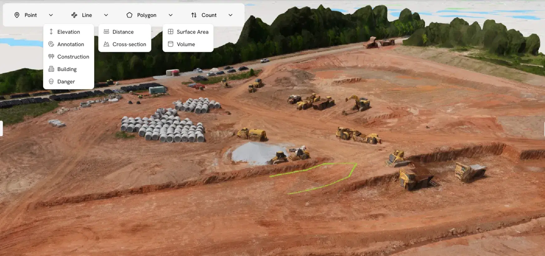
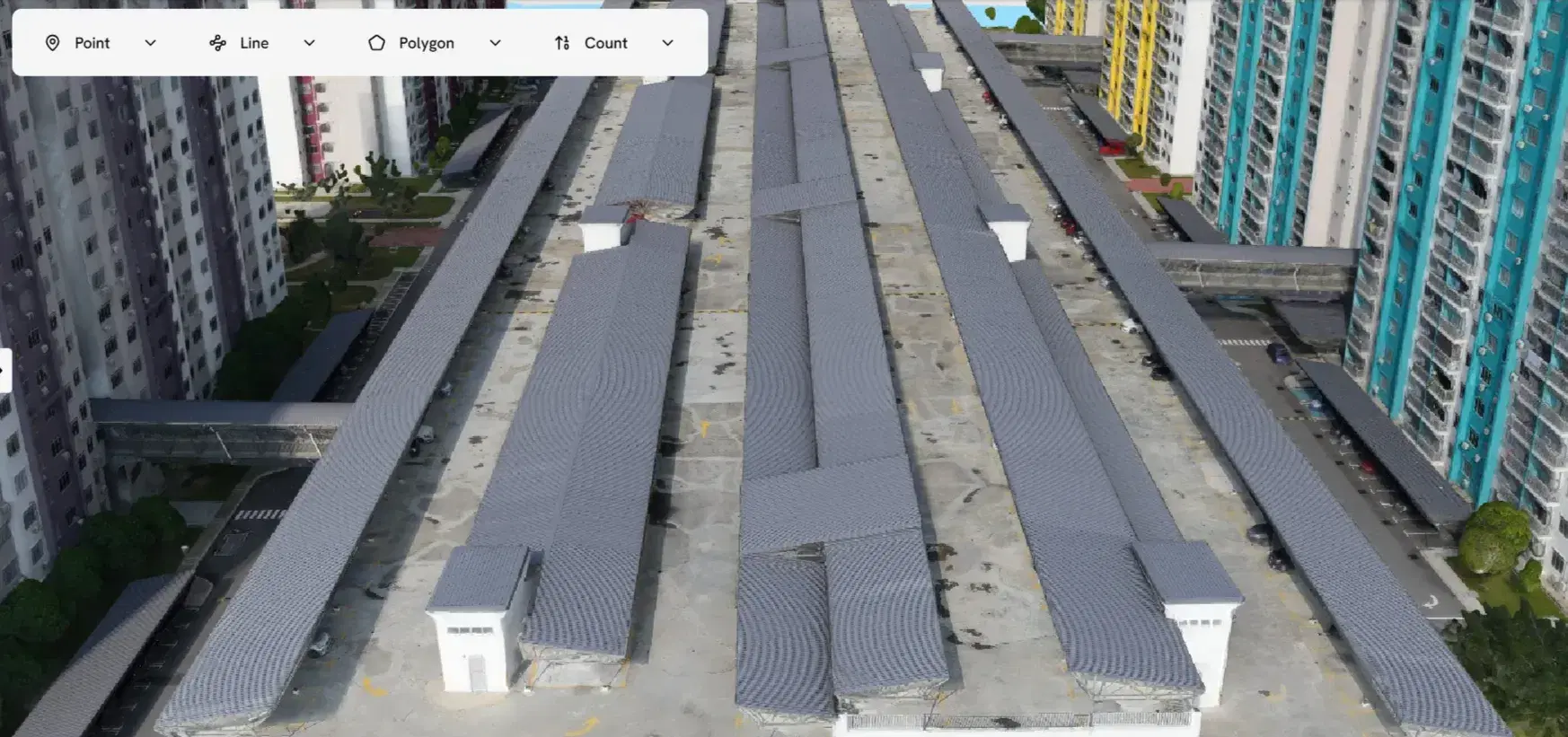
How It Works
Four steps from your first message to survey data in your hands.
Share Your Site Details
Tell us the location, area, project type, and timeline. You receive a written quote within 2 hours with no site visit required.
We Handle All Planning
Flight path design, GCP layout, DGCA airspace clearance, and equipment allocation are handled end-to-end. Nothing falls on your team.
Certified Pilots Survey Your Site
DGCA-certified pilots survey with RTK drones and capture complete, high-accuracy site coverage. One visit. Done right.
Deliverables Arrive in 24-48 Hours
Orthomosaics, DSMs, DTMs, contour maps, volumetric reports, and compliance outputs - delivered in the formats you need, ready to use.
Our Drone Survey Services
Specialized survey solutions for every project type across India - mining, construction, solar, roads, land, and agriculture.
Topographic Drone Survey
Survey-grade terrain mapping with GCP/RTK for civil engineering, infrastructure, and land development projects across India.
Mining and Quarry Survey
IBM Rule 34A compliant surveys for stockpile volume measurement, pit progression tracking, and DGMS compliance documentation.
Construction Site Monitoring
Monthly progress monitoring, RERA documentation, earthwork verification, and as-built records for NHAI, CPWD, and private projects.
Land and Property Survey
Boundary mapping, accurate area calculations, and geo-referenced orthomosaics for developers, landowners, and legal documentation.
Road and Highway Survey
NHAI-compliant corridor mapping, cross-section generation, and earthwork calculations for state and national highway projects.
Industrial and Solar Site Survey
Pre-construction terrain surveys for solar EPC, SECI/NTPC projects, industrial plant inspection, and PM-KUSUM scheme documentation.

Agriculture Drone Survey
NDVI crop health mapping, stand counts, PMFBY damage reports, and variable-rate prescription maps for Indian farms and agribusinesses.
What You Gain When You Work With Us
We own the processing infrastructure. That single difference changes every part of your experience.
You Get Data in 24–48 Hours
In-house processing infrastructure removes third-party queue delays. Your project schedule doesn't wait for our software vendor.
You Pay Less Per Acre
No expensive external software licensing overhead passed to you. Owned infrastructure means better pricing for every project size.
Your Data Meets Compliance Standards
IBM Rule 34A, NHAI, RERA, DGMS, SECI - deliverables are pre-structured for the authority that needs them. No rework.
Your Site Gets Covered, Wherever It Is
Deployment-ready survey teams across Mumbai, Delhi, Bengaluru, Hyderabad, Pune, Chennai, Ahmedabad, Kolkata, Jaipur, Nagpur, and all major project belts.
What a Successful Survey Engagement Looks Like
When survey data arrives on time and in the right format, your entire project runs differently.
Aeroyantra has surveyed 110+ sites across India - for mining companies in Odisha and Jharkhand, solar EPC contractors in Rajasthan and Gujarat, NHAI corridor projects in Maharashtra and Karnataka, real estate developers in Bengaluru, Hyderabad, and Pune, and farms across Punjab, Haryana, and Madhya Pradesh.
Recognition
Recognized by Startup India (DPIIT), supporting innovation in drone data processing and survey intelligence.

Prefer to Process Your Own Data?
If your team already flies drones, use our cloud platform for orthomosaics, DSMs, 3D models, and contour maps without desktop software or local GPU setup.
No credit card required • Cancel anytime • Process up to 500 images free